
Special guest and amateur draftsman Will Watkins of Park City, Utah joins us on a tour of the history of the transit map, a pedestrian feature of transit systems that we really shouldn't take for granted. We show off (tell about?) everything from the historic anchors that were the Tube maps to eccentric panoramic maps of San Jose and Utah. Visionaries like Harry Beck have established the design choices that make a transit map readable and good for its purpose, but not every agency has entirely caught on. Follow along in the timestamps below to see what we're talking about!
Links and stuffs
- Merch: https://shop.trlpod.com/
- Twitter: @TheRedLine_pod
- YouTube channel: The Red Line Podcast
- Spotify: The Red Line Podcast
- Patreon: https://www.patreon.com/theredlinepodcasters
- Email: [email protected]
- Website: https://www.trlpod.com/
Timestamps & visuals
- 00:00 Vignelli and his map - image
- 00:24 Theme song
- 00:56 Intro & meet our guest
- 01:50 The News
- 05:45 Early geographic transit maps
- 07:50 Panoramic view maps
- 07:57 Old UTA map - Transit Maps
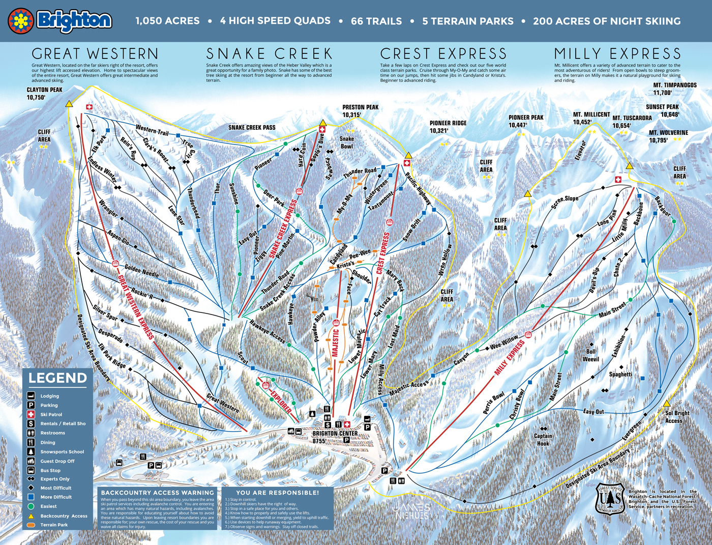
- 08:17 Ski resort map - image of Brighton (Utah)
- 08:36 San Jose - Transit Maps
- 08:54 45 degree station
- 09:17 Diagrammatic maps
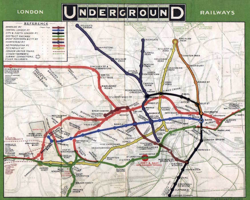
- 10:51 District line in 1908
- 11:10 Strip maps - District line and UTA TRAX
- 12:26 Map pull-down
- 12:42 UTA bus map - PDF
- 12:52 Diagrammatic maps are now the standard
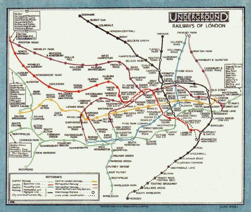
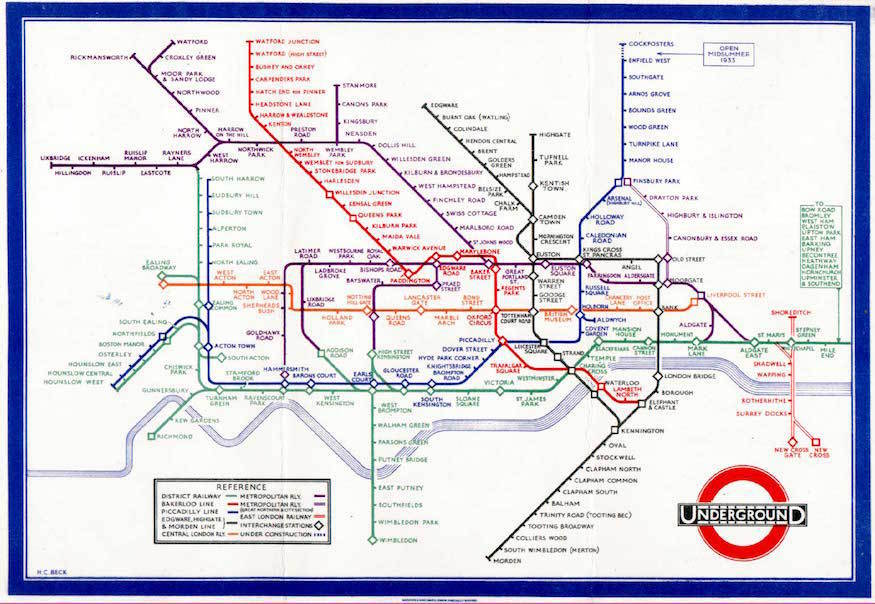
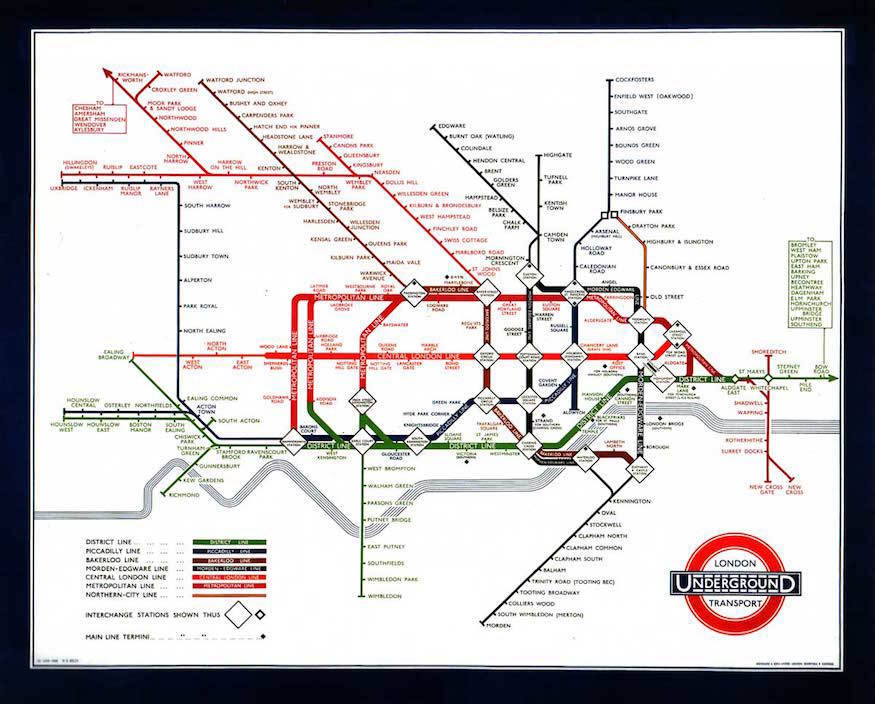
- 13:13 Evolution of the Tube map [3]
- 24:51 What makes a good transit map?
- 25:31 Communication first
- 25:53 Typography
- 26:09 Clear interchanges
- 26:54 Compactedness
- 27:33 Functionality specifically for transit
- 28:07 Navigating underground
- 29:10 Do one thing and do it well
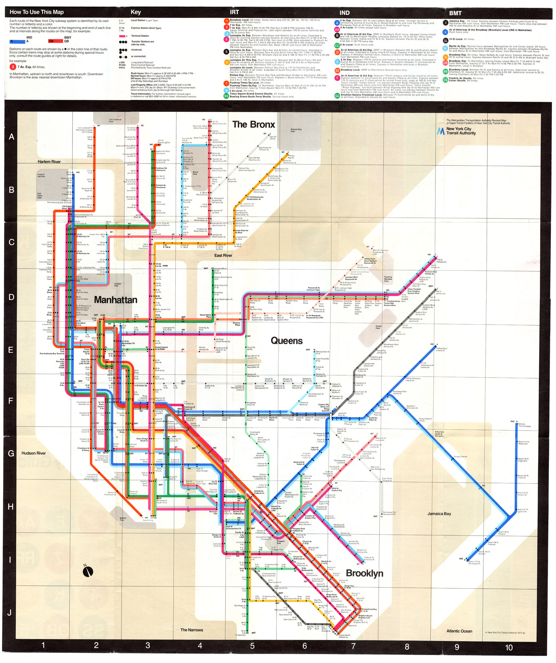
- 29:42 New York Subway - current [PDF] and Vignelli
- 31:57 UTA - old [Transit Maps] and current [PDF]
- 40:04 TTC 2030 map - Twitter @augustAP12
- 40:29 Paris - image
- 42:48 Moscow Metro - PDF
- 45:48 Singapore MRT & LRT - image
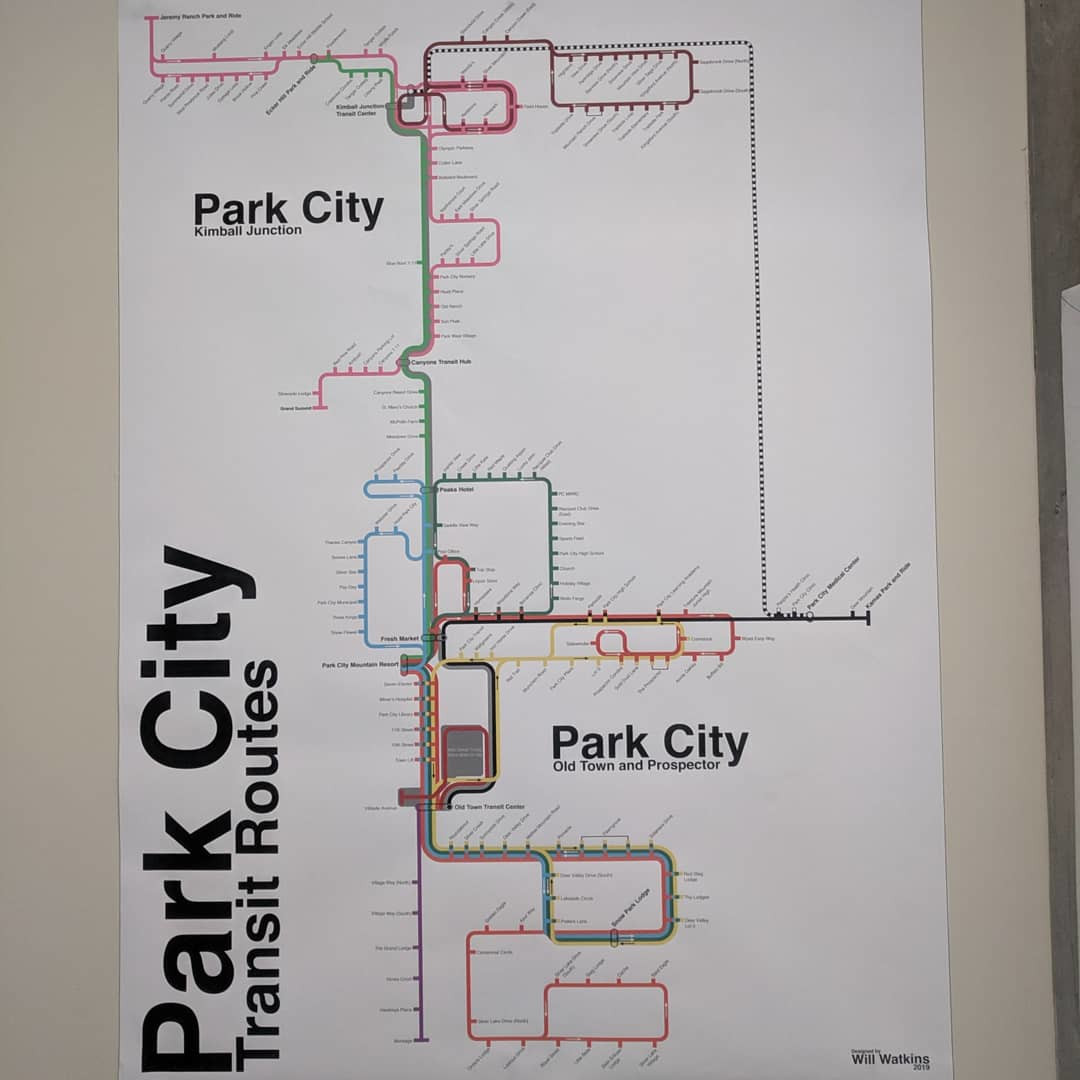
- 47:47 Park City, UT - PDF
- 52:05 Will's Park City map - image
- 53:32 Accursed Park City maps
- 54:46 TransMilenio - Transit Maps
- 57:37 Thanks, Will!; crayoning; and goodbye
References & notes
- [1] Mass Transit: TriMet's FX bus service begins on a transformed Division Street Corridor
- [2] DanvilleSanRamon: Details emerge about deadly motorcycle crash that shut down BART through Oakland for hours during Friday evening commute
- [3] Londonist: The History Of The Tube Map
- [4] Wikipedia: Transit map
- [5] Wikipedia: Harry Beck
- [6] A Tale of Two Maps: Analysis of the London Underground "Diagram"
- [7] Wikipedia: Tube map
- [8] BBC: The London Underground map: The design that shaped a city
- [9] Transit Maps (Will's favourite site)
- [10] Glantz Design: The World's Best Designed Metro Maps
- [11] Transit Maps: Tutorial: How To Design a Transit Diagram
- [12] Wikipedia: Massimo Vignelli